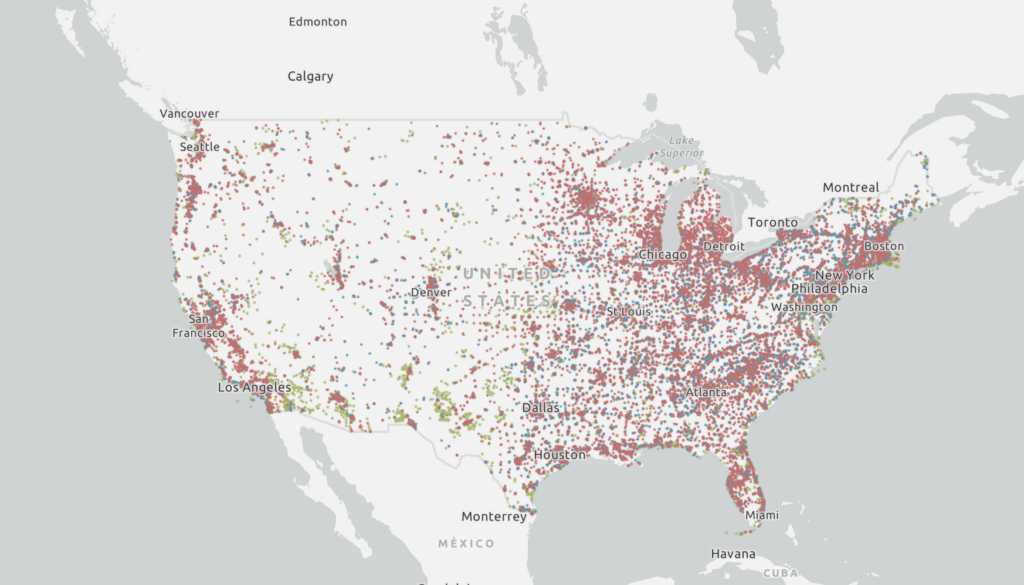
New study says more than 57,400 US sites have PFAS contamination
Scientists have identified more than 57,400 sites in the United States that can be presumed to be contaminated with toxins linked to cancer and other health problems, according to a study published on Wednesday.
The sites identified by the analysis include 49,145 industrial facilities, 4,255 wastewater treatment plants, 3,493 military sites, and 519 airports. A map of the sites is publicly available on a PFAS Project Lab website.
PFAS, an acronym for per- and polyfluoroalkyl substances, are a class of thousands of chemicals commonly used to make such things as food packaging, cookware, fabrics, paints, and fire-fighting foams. Exposures to some types of PFAS have been linked to a range of adverse human health issues, including certain types of cancer, birth defects, and reproductive issues.
To identify areas of potential PFAS contamination concern, researchers pinpointed three types of sites: those where aqueous film forming foam, a PFAS-containing fire suppressant, had been discharged; sites where PFAS are used in manufacturing or industrial processes; and sites where PFAS-containing waste is handled. The researchers then validated their model of presumed contamination sites with sites known to be contaminated.
In the study published Wednesday in the journal Environmental Science & Technology Letters, researchers from Northeastern University and Whitman College said attempting to accurately track PFAS contamination is challenging.
“PFAS contamination at these locations is very likely,” Alissa Cordner, senior author on the paper and co-director of the PFAS Project Lab, said in a press release.
State agencies vary in their abilities to accurately test for PFAS due to differences in testing costs, expertise, and time and resource constraints, the researchers said. As a result, they write, the amount of sites known to be contaminated is an underrepresentation of actual contamination, and far more sites can be presumed to contain PFAS.
“We know that PFAS testing is very sporadic, and there are many data gaps in identifying known sites of PFAS contamination,” Cordner said. That’s why the ‘presumptive contamination’ model is a useful tool.”
Mapping the danger
The researchers are among many public health advocates who are mapping the dangers of PFAS across the United States. The Environmental Working Group, which works in partnership with Northeastern University, reported in June that 2,858 locations in 50 states and two territories were “known to be contaminated.”
And last year, the EPA listed more than 120,000 sites in the country as facilities in industries that may be handling PFAS. The locations listed by the EPA included manufacturing sites, waste management sites, airports, military facilities, and landfills.
The number of sites identified is likely a significant underestimation for a number of reasons, according to Cordner. In some cases, such as with firefighting training facilities or certain agricultural lands, location data is hard to come by.
The researchers suggest that their approach and data should be used by state and federal agencies to identify and prioritize locations to monitor PFAS and enact remediation.
“This model provides a really good screening tool for folks who might be thinking about how to direct testing resources to look for where contamination is pretty likely,” she said.
The researchers hope the results of the study will be used by residents wanting more information about their exposure in their neighborhoods, too, especially since such data is not always available. “It continues to strike me as a little bit sad how little data we have on some of these known risks related to PFAS,” said Cordner.
“We really need to be turning off the tap in terms of ongoing emissions of PFAS,” she said.


